/filters:quality(90)/fit-in/970x750/coros-web-faq/upload/images/75418f8c0ea8a8b2ba0d356713eb7f5b.jpg)
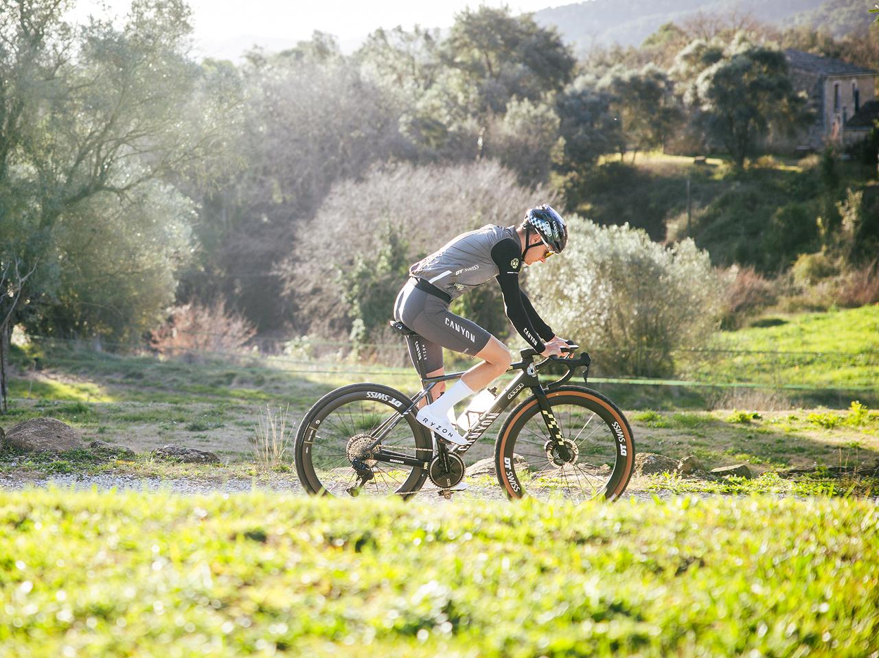
Backcountry ski touring is about exploration, efficiency, and safety. Having the right tools can elevate all three. If you’re heading into the mountains for a ski tour, here’s how to make the most of your COROS device.
Why Use COROS for Ski Touring?
COROS has become a favorite among backcountry ski athletes. Unlike resort skiing, ski touring involves variable terrain, route finding, and long ascents. COROS watches are particularly well-suited for this because they offer:
- Reliable GPS tracking in remote areas
- Excellent battery life for long days (or multi-day tours)
- On-wrist navigation and route-following
- Elevation tracking and ascent/descent metrics
Quick Guide: 7 Steps to Using COROS for Ski Touring
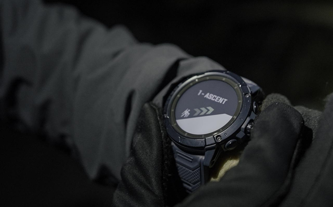
- Choose the right COROS product. The VERTIX 2S and APEX series include a dedicated Ski Touring mode that automatically tracks skinning, transitions, and descents.
- Load or build your route. Upload a GPX file from CalTopo, Gaia GPS, or similar apps, or build your route directly in the COROS app and sync it to your watch.
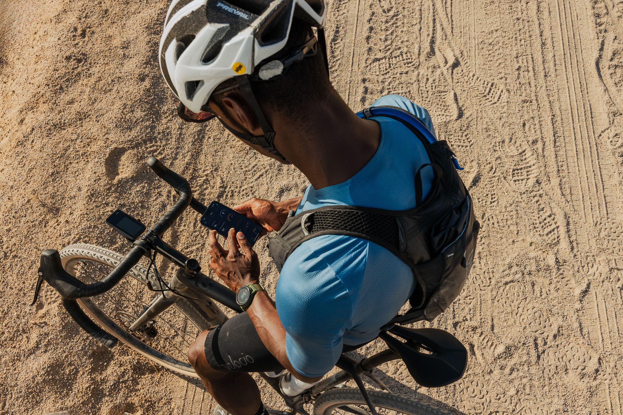
- Start tracking at the trailhead. Wait for a strong GPS signal, start the activity, and lock your screen before heading out.
- Monitor elevation, pace, and effort. Use real-time metrics—current elevation, vertical pace, and heart rate—to manage your effort and stay on schedule throughout the climb.
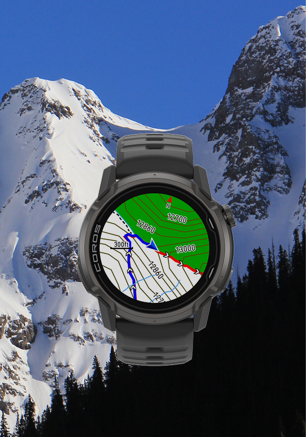
- Navigate safely. Pair your watch’s real-time tracking with a topo map to confirm your line, stay on lower-angle terrain, and avoid unintended exposure—especially in low visibility or complex terrain.
- Mark points of interest with Voice Notes. Use Voice Pins to capture GPS-tagged audio notes for avalanche observations, snow conditions, route decisions, and hazards—without stopping to type.
- End and review your activity. Save and sync to the COROS app for a full GPS record, performance insights, a Recovery Timer, and a growing backcountry journal you can reference for future trips.
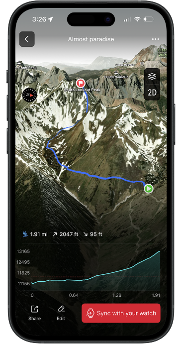
Load or Build Your Route
Planning your route ahead of time is one of the best ways to stay efficient and safe in the backcountry. COROS gives you two solid ways to do it.
Option 1: Upload a GPX File
If you prefer using external mapping tools:
- Plan your route in apps like CalTopo, Gaia GPS, Strava, or onX Backcountry
- Export the GPX file
- Upload it to the COROS app
- Sync it to your watch
This is a great option if you’re already using detailed mapping platforms for avalanche terrain analysis or trip planning.
Option 2: Build a Route in the COROS App
You can also create your route directly within the COROS app without any third-party tools.
- Open the app, go to the Explore tab, and tap Create Route
- Trace your intended skin track and descent line on the map
- Adjust waypoints as needed for terrain and distance
- Save and sync the route to your watch
This built-in planner is especially useful for quick tours or when you want a simple, streamlined workflow without exporting files.
Once your route is on your watch, you can follow it using your watch's navigation. This helps you stay on track in low visibility, dense trees, or unfamiliar terrain, giving you more confidence as you move through the mountains.
If you go off course, your watch will give a Deviation Alert, letting you know how far you've strayed and how to get back on track. If you like to wander without being notified, this feature is easily disabled in your activity settings.
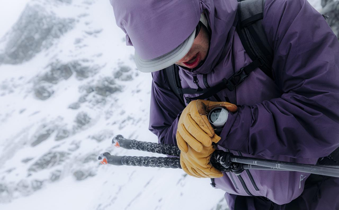
Monitor Elevation, Pace, and Effort
Once you've started your adventure, your watch doesn't just collect data in the background. During your tour, you'll receive real-time feedback to help you make better decisions as your tour unfolds.
The most useful metrics to keep an eye on are:
- Current elevation & elevation gain: Checking your current elevation against your planned high point helps you understand exactly where you are in the climb and how much vertical you still have to go. This is especially useful for pacing big objectives or timing transitions.
- Vertical Pace: Monitoring your pace helps you stay consistent on the skin track. If you know your ascent rate, you can quickly estimate how long it will take to reach a ridge, summit, or turnaround point—and adjust if you’re moving slower or faster than expected.
- Heart rate: Your heart rate is one of the best indicators of effort. Keeping it in a sustainable zone helps prevent early fatigue, which is critical for long tours or days with multiple laps.
Used together, these metrics give you a clearer picture of your progress, how much energy you’re spending, and whether you’re on track with your plan.
Navigate Safely
Your watch is a powerful tool, but it works best when paired with a solid understanding of the terrain around you. That’s where having a map (especially one with clear topo lines) becomes essential.
Topo lines give you a detailed picture of slope angle, terrain features, and how the landscape is shaped. By referencing them throughout your tour, you can confirm that you’re following the intended skin track, staying on lower-angle terrain when needed, and avoiding unintended exposure to steeper slopes.
This is particularly important in low visibility, unfamiliar zones, or complex terrain where it’s easy to drift off your planned route without realizing it. A quick check of your position against a topo map can help you catch small deviations before they turn into bigger problems.
Think of your watch as your real-time tracker, and your map as the bigger-picture guide. Used together, they give you a much more complete understanding of where you are and where you’re going.
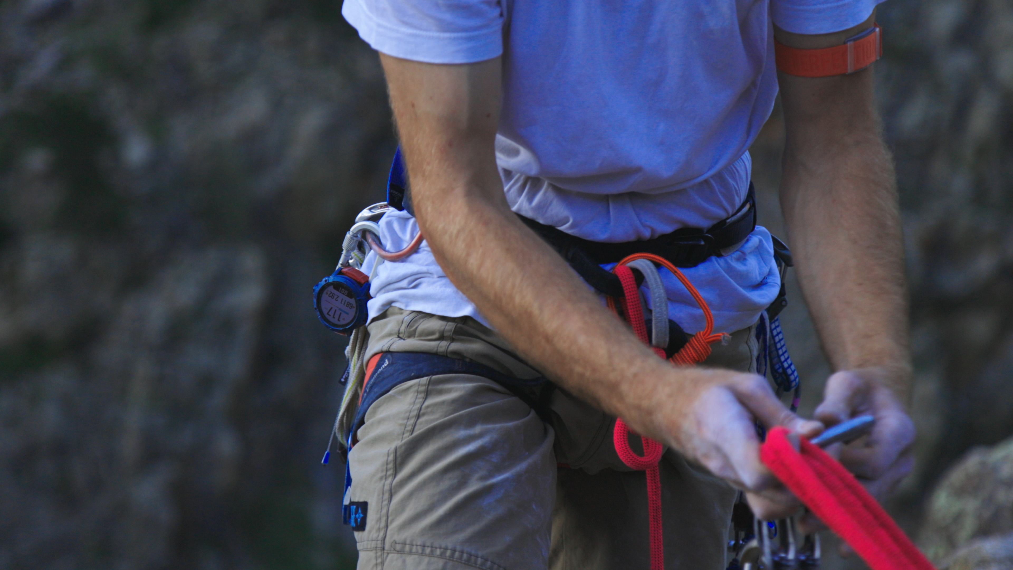
As always, your watch should complement—not replace—essential backcountry skills. Carry a map and compass, know how to use them, and make sure you have proper avalanche training and gear before heading into the backcountry.
Mark Points of Interest with Voice Notes
One of the most underrated features on COROS watches is Voice Pins, which let you quickly record audio notes tied to a specific GPS location that can be viewed on the map screen of your watch, or in the activity summary after your tour.
In the backcountry, this becomes incredibly useful for capturing real-time observations without stopping to pull out your phone and type.
Here are a few practical ways to use Voice Pins on a ski tour:
- Avalanche observations: Record snowpack details, recent avalanche activity, or red flags like cracking or collapsing. These notes can be useful later for debriefing or sharing with partners.
- Snow conditions: Log where you see powder, wind slabs, crusts, or changing conditions across aspects and elevations.
- Route decisions: Drop a pin when you choose a safer ascent line, avoid a slope, or change your plan. This helps you review your decision-making afterward.
- Transition points: Mark where you switch from skinning to skiing (or vice versa). This can help you analyze flow and efficiency later.
- Hazards and terrain features: Note obstacles like cliffs, open creeks, glide cracks, or heavily loaded slopes.
- Navigation checkpoints: In low visibility or complex terrain, marking key locations (trail junctions, ridgelines, exits) can make retracing your route much easier.
End and Review Your Activity
At the end of your tour, save the activity & sync it with the COROS app.
Once your recording is saved, you’re left with a complete picture of your day in the mountains. COROS turns a single tour into a useful record you can learn from long after you’ve left the trailhead.
You’ll have three key takeaways:
A complete GPS and activity record: Your file includes an accurate GPS track of your route, along with heart rate data, elevation, speed/pace, and other performance metrics. If you used Voice Pins, those notes are also tied directly to specific locations on your track, giving you context for decisions, conditions, and key moments from the tour.
Performance and recovery insights: Beyond just seeing what you did, you can evaluate how hard you worked. Heart rate trends, time in different effort zones, and overall exertion help you understand your pacing and endurance. After the tour, these same metrics can also inform recovery. COROS will give you a Recovery Timer to gauge how fatigued you are and when you’re ready for your next big day.
A personal backcountry journal: Over time, each activity becomes part of a searchable history of your ski touring experience. You can look back on specific days to compare conditions, routes, fitness, and decision-making. It becomes a valuable reference for planning future objectives and learning from past tours.
Together, these turn your watch from a real-time navigation tool into a long-term training log and backcountry journal.
With a bit of setup and practice, COROS becomes a powerful companion for every tour, from quick dawn patrol laps to big alpine objectives.
Get comfortable with your device before heading into serious terrain, and you’ll have one more tool to help you move safely and confidently through the backcountry.